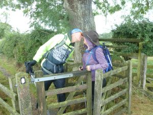
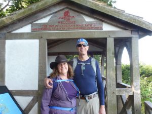
 One of the most memorable things we did while in England was to start out our trip by hiking across England along Hadrian’s Wall. Hadrian was a Roman emperor who built a defensive wall 73 miles across the width of England in 122 AD, and much of the wall still exists today, along with the ruins of forts and defensive fortresses. It runs from Newcastle on the east to the little town of Bowness on the Irish Sea, and it was the northern boundary for the Roman Empire. It’s a UNESCO world heritage site, and there are taverns and bed and breakfasts along the route, making it an easy and enjoyable hike. You can even hire a service, Hadrian’s Haul, which will bring your pack to your stopping points each night so you only have to carry a daypack on the route.
We took nine days to do the walk, including a down day at the tiny town of Twice Brewed, where the amazing fort of Vindolanda is being excavated, and there are some world class museums.

Our ‘bible’ for the route was a book called Hadrian’s Wall Path by Henry Stedman. It had very detailed maps, plus noted every place to stop and to eat. Absolutely invaluable! The other thing I was really glad I had was walking poles. They weren’t really necessary for the beginning and end of the hike, but in the middle, wild part, where it’s rocky and a bit hilly, they were terrific. You’re in England, so of course rain gear is also a necessity, although we only had one half day of drenching rain the entire trip.
Our Itinerary
Note we started a few miles from the beginning of the route. Maps refer to the maps in in the Hadrian’s Wall Path guide book. The miles noted were from the guidebook, but my fitbit told me we walked a lot further. I think the guide book is how the crow flies – so go a little easy on yourself with planning. This was just our route – you will probably want to adjust to your own needs and walking ability.
Day One – 10.5 miles
 Start at the Marriott in Newcastle: Millennium Bridge (map 3) to just past Heddon on the Wall (map 8), stay the night at Houghton North Farm. (very nice hostel-like accommodations)
Day 2 – 9 miles to bus to Corbridge – or 2 mi additional walk to Corbridge
End map 13 for bus or map 13a for Corbridge. Stay at The Hayes in Corbridge. (a bit out of the way, very old but gracious couple who ran the inn.)
Day 3 – 12.5 plus 2 miles from Corbridge
End map 19 at Old Repeater Station. Stay at Old Repeater Station. Our favorite place we stayed on the route. If you stay here, make sure you request dinner – there’s no place else anywhere around to eat.
Day 4 and 5: 6 miles on path, 1 mile to inn
End map 23 by the Twice Brewed Inn. End map 23 at the Snug cottage for the Vallum Lodge. Nice enough place, but we didn’t like their packed lunch.
Day 6: 10 miles Inn to Inn
End map 28 in Gilsland, Stay at the Brookside Villa. One of our best breakfasts.
Day 7: 13.5 miles

End map 36, Stay at the Park Broom Lodge just past Crosby on Eden. Very nice restaurant on site.
Day 8: 13.5 miles
End map 42, stay at Highfield Inn A small B&B on a horse farm run by an extremely nice lady.
Day 9: 5.5 miles
End at Bowness, take a bus to Carlise, then train to York.